Geospatial Intelligence
In today’s world, information is everything, but it can be a challenge to come by the right information at the right time in the right format. Airbus supports its customers with technologies and capabilities to strengthen how they plan and respond to challenges and missions - with greater speed and higher certainty. From data acquisition and processing, to advanced analytics and data management, Airbus U.S. provides sophisticated geo-information services and turnkey integrated solutions that deliver exactly what customers need, when and where they need it. Our customers benefit from the experience and exclusive capabilities of a pioneer in Earth observation and geo-information services, and the rigor of an organization working for hundreds of satisfied customers and partners, in both the private and public sectors.
Pléiades satellite image of Wuhan, China Corona Virus Hospital. PLEIADES © CNES 2020, Distribution Airbus DS
Pléiades satellite image of Wuhan, China Corona Virus Hospital. PLEIADES © CNES 2020, Distribution Airbus DS
Geospatial Intelligence
In today’s world, information is everything, but it can be a challenge to come by the right information at the right time in the right format. Airbus supports its customers with technologies and capabilities to strengthen how they plan and respond to challenges and missions - with greater speed and higher certainty. From data acquisition and processing, to advanced analytics and data management, Airbus U.S. provides sophisticated geo-information services and turnkey integrated solutions that deliver exactly what customers need, when and where they need it. Our customers benefit from the experience and exclusive capabilities of a pioneer in Earth observation and geo-information services, and the rigor of an organization working for hundreds of satisfied customers and partners, in both the private and public sectors.
Pléiades satellite image of Wuhan, China Corona Virus Hospital. PLEIADES © CNES 2020, Distribution Airbus DS
Geospatial Intelligence
In today’s world, information is everything, but it can be a challenge to come by the right information at the right time in the right format. Airbus supports its customers with technologies and capabilities to strengthen how they plan and respond to challenges and missions - with greater speed and higher certainty. From data acquisition and processing, to advanced analytics and data management, Airbus U.S. provides sophisticated geo-information services and turnkey integrated solutions that deliver exactly what customers need, when and where they need it. Our customers benefit from the experience and exclusive capabilities of a pioneer in Earth observation and geo-information services, and the rigor of an organization working for hundreds of satisfied customers and partners, in both the private and public sectors.
TerraSAR-X satellite image of Tokyo, Japan © DLR e.V. 2020 and © Airbus Defence and Space GmbH 2020
Airbus U.S. WorldSAR Constellation
The TerraSAR-X family of Synthetic Aperture Radar (SAR) satellites (TerraSAR-X, TanDEM-X and PAZ) reliably acquire high-resolution and wide-area radar images, independent of weather and light conditions, and within a dusk/dawn orbit, which is outside of standard Electro Optical orbital patterns. The WorldSAR constellation orbits at a height of 514 km above the Earth and provides radar imagery to a wide variety of government, scientific and commercial users. The satellites feature a unique geometric accuracy that is unmatched by any other commercial space borne sensor. Image acquisition modes include Staring SpotLight, High Resolution SpotLight, SpotLight, StripMap, ScanSAR and Wide ScanSAR. View Radar Satellite Services Brochure View Technical Specifications
Our Very High Resolution Optical Capabilities
Airbus U.S. is the go-to supplier for complete Earth observation satellite systems. Our comprehensive portfolio means Airbus is able to provide the right satellite and system for every customer – whether they need a weather-independent data source, frequent images acquired over their area of interest (AOI), very high-resolution imagery or even all of the above. View Optical and Radar Data
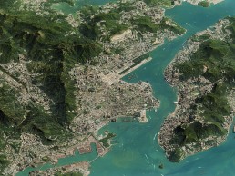
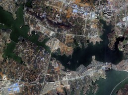
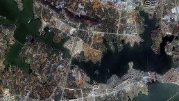
Pléiades satellite image of Hong Kong. PLEIADES © CNES 2018, Distribution Airbus DS
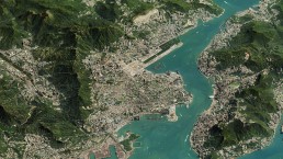
Pléiades satellite image of Hong Kong. PLEIADES © CNES 2018, Distribution Airbus DS
Our Very High Resolution Optical Capabilities
Airbus U.S. is the go-to supplier for complete Earth observation satellite systems. Our comprehensive portfolio means Airbus is able to provide the right satellite and system for every customer – whether they need a weather-independent data source, frequent images acquired over their area of interest (AOI), very high-resolution imagery or even all of the above. View Optical and Radar Data

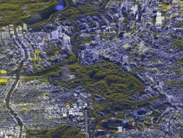
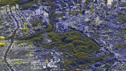
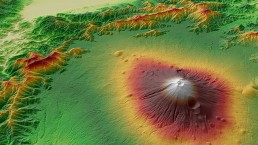
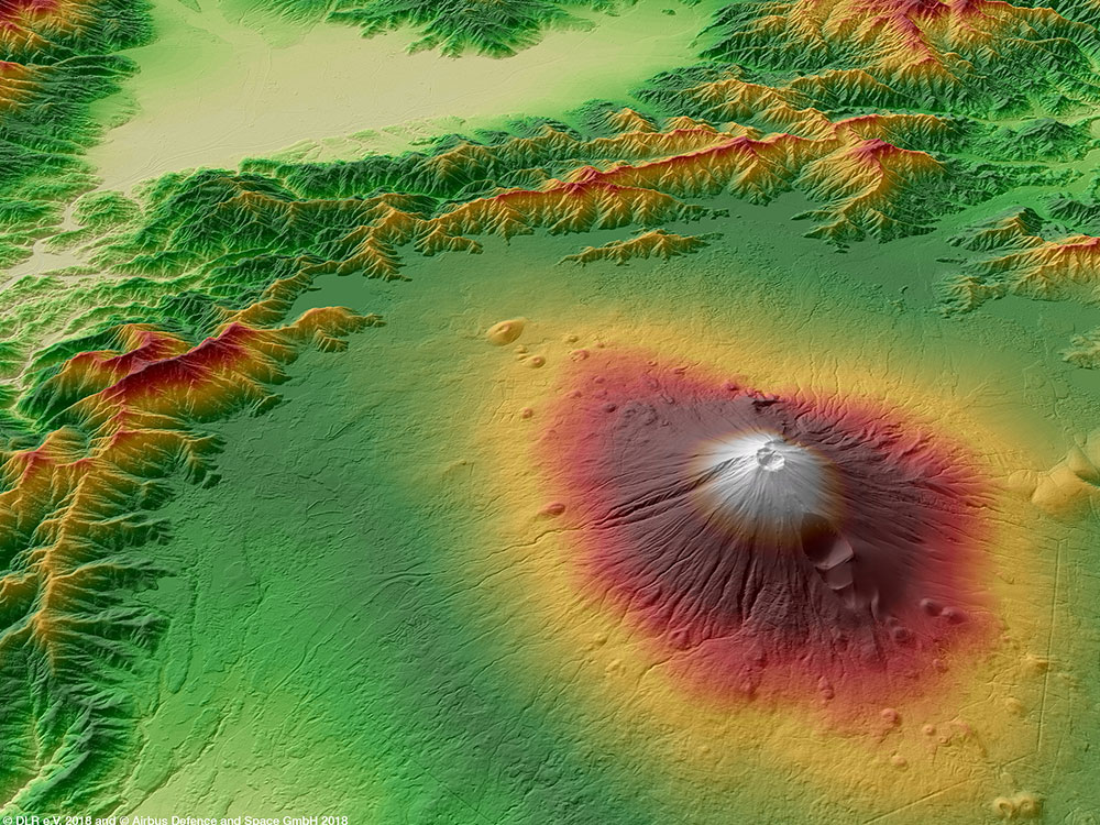
WorldDEM™ Image - Mount Fuji, Japan © DLR e.V. 2018 and © Airbus Defence and Space GmbH 2018
WorldDEM Digital Elevation Models
The first global elevation dataset with standardized 12-m coverage from pole to pole of the Earth. The data set is derived from stereo radar pairs collected by the twin satellites, TerraSAR-X & TanDEM-X. WorldDEM is a high-quality elevation layer that is free from common radar-induced anomalies and is the ideal solution for all mapping projects requiring accurate elevation models including orthorectification, floodplain determination, mineral exploration and hydrocarbon development, etc. Airbus U.S. has edited the entire global data set into a Digital Surface Model, which is available off-the-shelf. View WorldDEM Technical Specifications Brochure
Need More Information?Contact Us.
Need More Information?Contact Us.
Need More Information?Contact Us.